13th_Europe_Report -- 13_2014_google_view.jpg
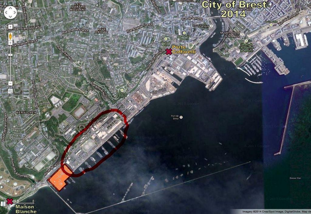
This screen capture ("Snip") of a Google Satellite View shows the part of the
Brest Naval Base that stretches southwest of the entrance of the Penfeld River.
The red "X" in upper center (below) shows
the location of the main Base gate where we met our friend Monique and were
introduced to Commander Nicol. The red "X"
in the lower left marks the
Maison Blanche area we visited on the previous Monday. The area
circled by the red oval indicates the approximate location of the WWI US Naval
Air Station. The orange rectangle is the huge submarine pen built by the
the occupying German forces in WW II and is still in use by the French Navy.
You might find it interesting to compare this 2014 satellite view to the next
page that gives a similar aerial view of this area from 1919.
First |
Previous Picture |
Next Picture |
Last | Thumbnails

